Map of Lofoten Best Of Edition | Guide to Lofoten

BEST PLACES TO SEE

Lofoten Map
15$
14 $
  • Six described must-do hiking trails + links to the trail maps
  • Photogenic "Insta Places"
  • Our favorite cafés, lunch, and dinner spots
  • Recommended accommodations
  • Most used ferry connections + ferry schedules
  • Best Lofoten saunas
  • Selected must-do summer activities
  • Recommended museums
  • Location of hospital & emergency room
  • Free in-app updates
  • Lifetime access
Zuzana Blazkova
Map of Western Norway: Hidden Gems
Read More
We used the interactive map of Western Norway during our week-long trip with a one-year-old girl. With my little one, I no longer have the time or desire to try to study everything about the destination by myself. Moreover, it is often impossible to stumble upon lesser-known gems, so I really appreciated having all the information in one place. As a lover of maps, I was delighted with the format, which is unique and innovative on the market. Other destination products sell text and photos, but you must put the location on the map yourself. Radka & Ivar sell this map as a layer of Google Maps, which is absolutely brilliant! You do not need any additional app/book. You simply open the map and immediately see color-coded tips on natural, cultural, and other attractions in the area. Great!!!
Adriana Gazova
Hiking Map of Lofoten & Best of Western Norway
Read More
When planning our vacation to Lofoten and western Norway, there was so much different information that I didn't know where to start. Then I discovered this site and the Interactive Map of Lofoten and Western Norway. I have yet to try it in practice (we will travel in the summer), but I can already write that the maps look fantastic. Everything is in one place, and it includes descriptions and links. I really like the information about the hikes with the time of ascents, elevation, difficulty, and the links to the trail maps. These beautiful maps are definitely worth buying. I'm already looking forward to how the maps will make our vacation more pleasant and easier 😏
Megan O'Malley
Camping Map of Lofoten & Best of Western Norway
Read More
I am so excited to use this map! At first glance it has been super easy to use and the descriptions or the points of interest are fantastic. I can tell a lot of work has gone into making this map very helpful and useful.
Sean Lipinski
Camping Map of Lofoten
Read More
This guide was extremely helpful and had a lot of the great site seeing and hiking locations, would definitely recommend for anyone who is traveling in Lofoten!
Previous
Next

FAQ ABOUT LOFOTEN HIKING MAP

When planning your trip, you will read a lot of different information from different sources like travel blogs, Trip Advisor, Youtube videos, Instagram, and Pinterest. You name it. But how should you store all the tips you get? 

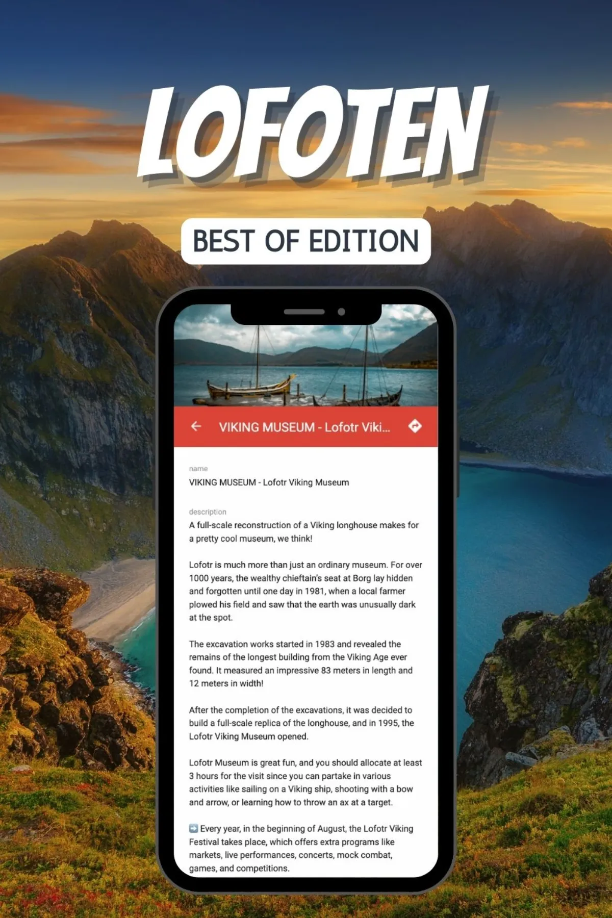
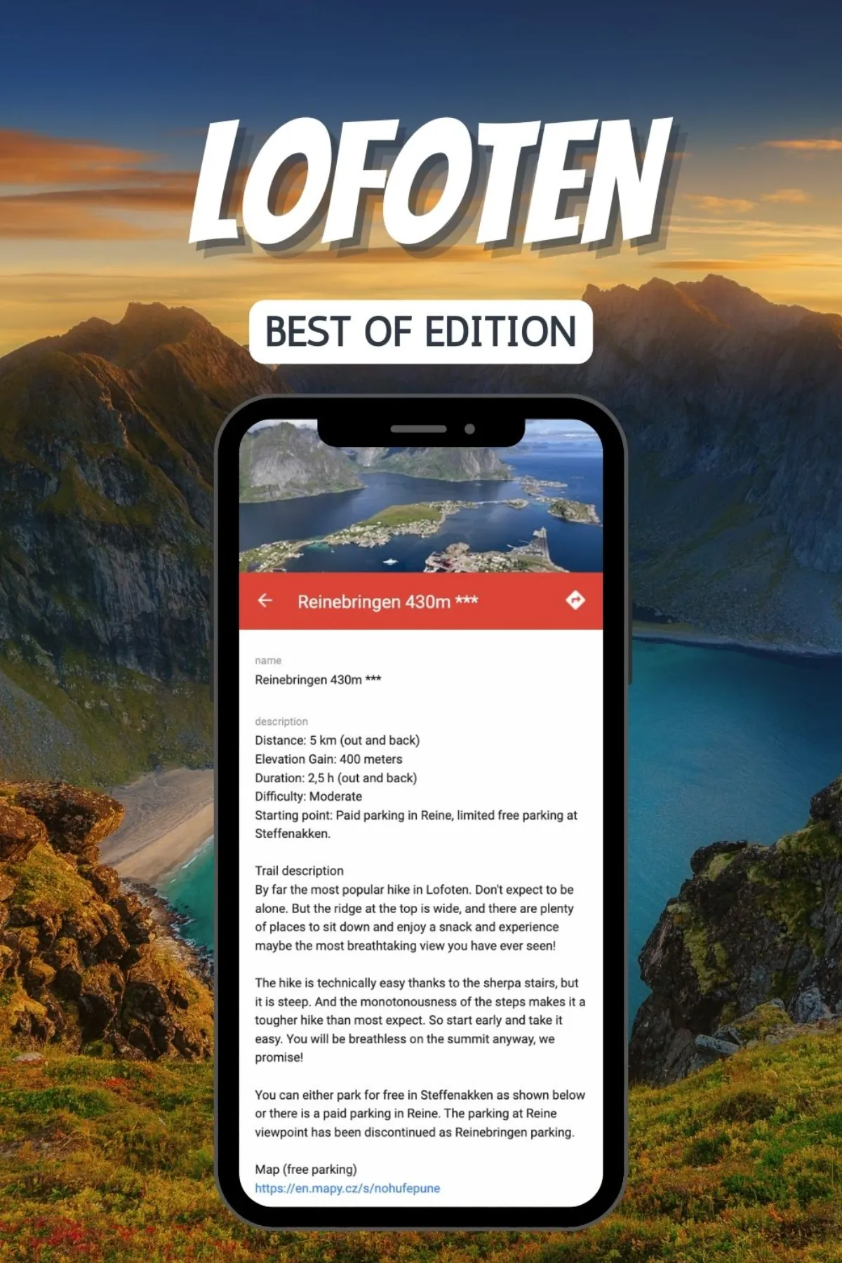
The ideal way is to pin the locations to Google Maps. However, finding all the correct information and coordinates of the sites can take a lot of work.

Stop pinning often outdated information from travel bloggers who visited Norway/Lofoten years ago. With this map, you will have all the information readily available on your phone/PC, and you can use it both while planning the trip or traveling.

Moreover, we regularly update the information in our maps. We do a major update once a year and more minor updates every time new information pops up.

Unfortunately, not. The maps are built in Google maps app. So, you will need an internet connection for the maps to work. 

The installation is easy!

  • To access the interactive map, you will need to have a Google account (Gmail), and you will need to download Google Maps.
  • After purchasing, you will get access to the map.
  • To make it even easier, you can follow a really short installation guide that we send you with the invitation to access the map. 


Please note that we have to grant your access manually, so allow us 24 hours from the time of purchase to do so. 

The map is accessible on any device that supports Google Maps.

For better planning, it is better to use the map on the desktop computer to see the pictures (mobile app doesn’t show them) and have clickable links.

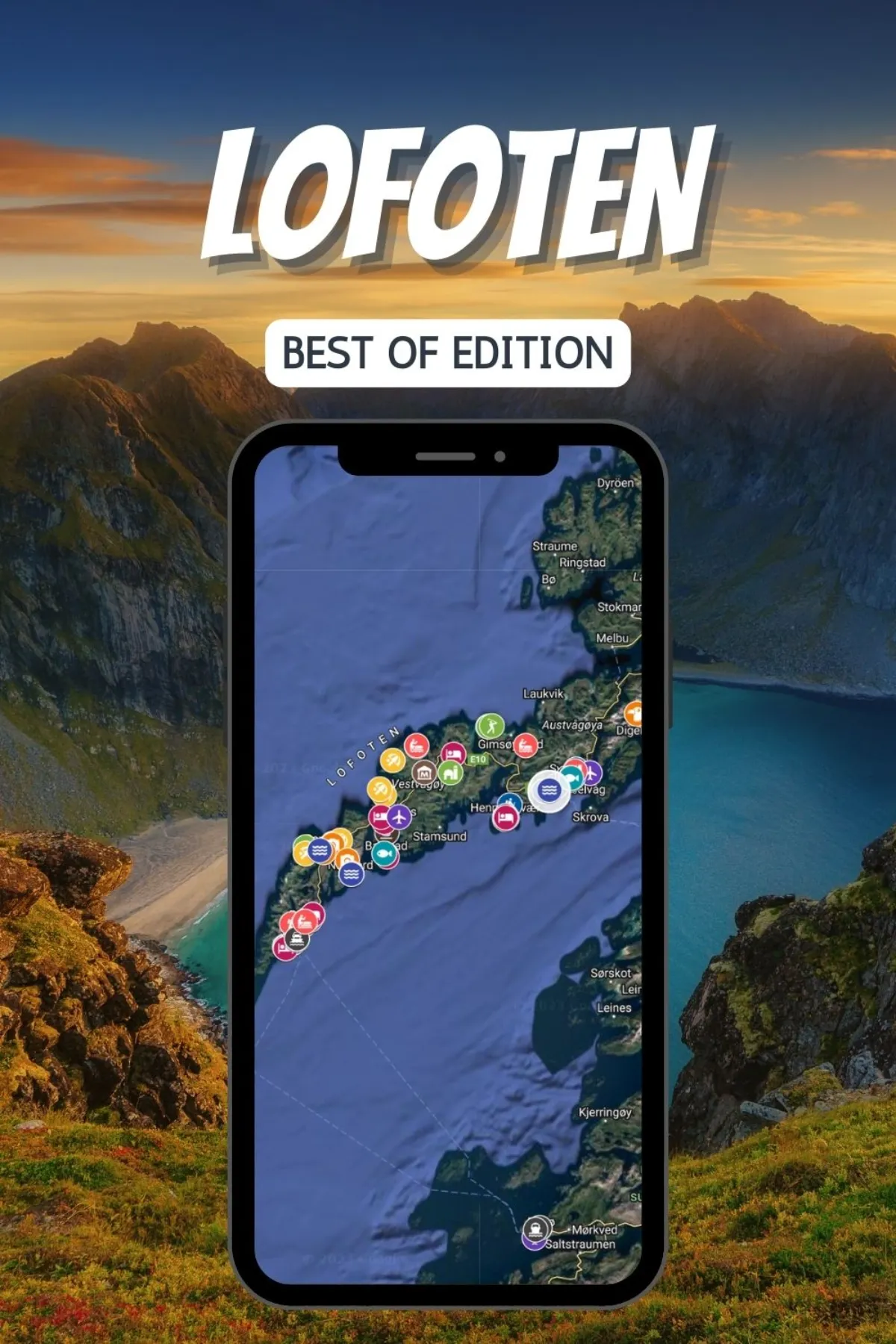
The map is divided into several layers, which you can display or hide based on your interests. 

  • Hiking trails: We divide all the hiking routes into three color codes, green being the easiest, blue moderate, and red hard. The color coding is meant to reflect the distance or altitude gained and the technical difficulty of any route. Most green routes can be done with kids or dogs.

  • Accommodations: All accommodations have a certain number of $-signs in the description to tell you approximately how expensive the housing is. $ means that a room for two costs up to 1000 NOK in the summer. $$ means a room for two costs up to 2000 NOK, and so on. A few of the accommodations only have larger cabins or cottages for six or more people, so we divided the total price by 3 (6/3=2) to get a price that can be compared to the rest. So if you are a couple, then a few of the hotels with only $$ might still be very expensive for you.

  • Ferries: There are a lot of ferries on this map! The web pages we refer to with the ferry schedules should be updated automatically by the ferry companies. We will do our best to make sure they are working, but if you find a faulty link or an outdated ferry schedule, then let us know so we can update it ASAP.

  • Airports: If you are a big group then taxi or maxi taxi would be the cheapest, or sometimes only, option to get from the different airports to the cities in Lofoten, except for Evenes. You can read more about prices on the individual icons. The taxi prices we have written are only meant to be a guideline. We got them from the taxi companies themselves, and it varies depending on the time of day, weekend/weekday, holiday, etc.

Due to the proprietary nature of the content these maps cannot be adjusted, saved or downloaded to devices.