The Lofoten Islands have so much to offer, from beautiful fishing villages and white sandy beaches with turquoise waters to mountain hikes with magnificent views. You want to see it all! However, we understand that organizing a holiday in a foreign country can be overwhelming, especially if it is your first visit. This is where a map of Lofoten sights would come in handy.
Here are our tips for six apps and maps of the Lofoten Islands that can be useful for planning your trip to Lofoten or while hiking in the mountains on the islands. You can print them out or use them from your smartphone, even when you’re offline.
In addition, at the end of the article, we will show you a bonus map of Lofoten created by our friend Martin Kulhavy that will take your breath away!
Table of Contents
INTERACTIVE MAPS OF LOFOTEN
When we moved to Lofoten in the spring of 2021, we started researching the hiking possibilities around our new home in Fredvang. Soon we had a long bucket list, and we could not remember which hike was which and where we read the information about it.
Not surprisingly, while running a rorbu (traditional fishermen’s accommodation typical for Lofoten Islands), we had little free time. So when we had extra time, we wanted to be outside, hiking, and not searching for the information we had already read. Therefore we started to create an interactive map of the Lofoten Islands that would contain all the information about hiking trails in Lofoten. It quickly grew to a collection of most hikes in the Lofoten islands.
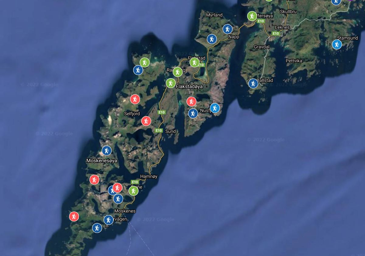
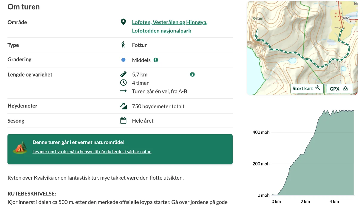
Our interactive map of Lofoten includes 50 hiking trails color-graded based on their difficulty. For each hike, there is information on the distance, elevation gain, time estimate, and the parking situation. Moreover, we added a short description of the hike mentioning difficult or exposed sections of the trail and a link to the route on a hiking map.
This way, whenever we had time to go hiking, we just checked the interactive map and chose a hike that fitted our schedule. The map works perfectly on the google maps app, so you do not need to download any other application, except perhaps mapy.cz, which we will discuss in the next paragraph.
ALL ABOUT LOFOTEN IN ONE PLACE
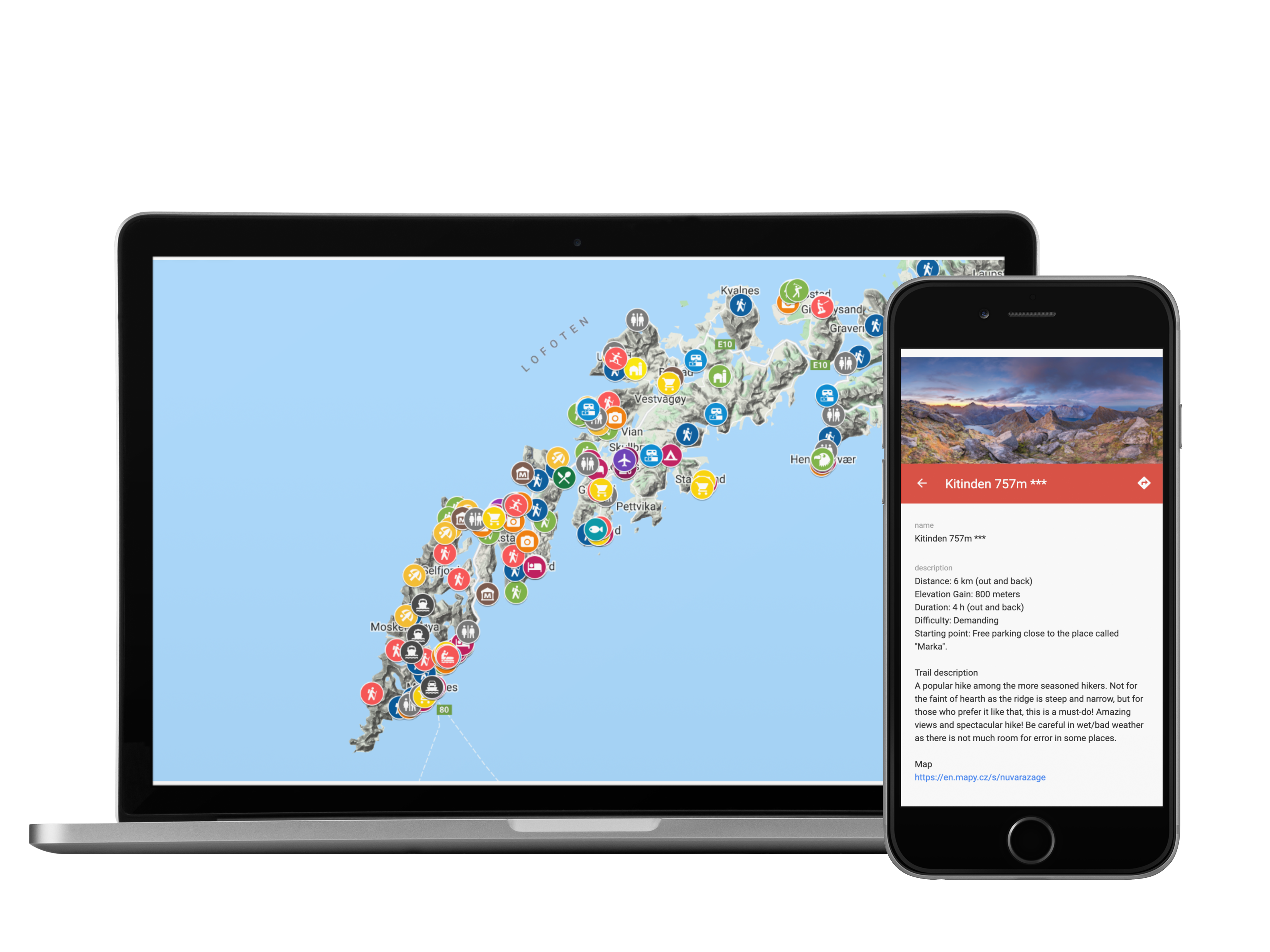
The interactive map of Lofoten is a set of more than 200 points of interest in the Lofoten islands entered into the Google Maps app.
All POI are marked with icons and divided into layers according to categories: hiking trails, churches, and museums, recommended accommodation and campsites, practical information, activities, etc.
In addition, all places include a short description and links to official sources of information.
To give you an idea of what the interactive map of Lofoten looks like, here is a little sneak peek that shows some of our favorite accommodations and activities in Lofoten.
MAPY.CZ – ONE OF THE BEST HIKING APPS
Mapy.cz is, in our opinion, one of the best apps for hiking on the market. Ivar primarily used ut.no and Norgeskart to plan his hiking trips, but Radka (originally from the Czech Republic) introduced him to Mapy.cz app. Specifically for the Lofoten Islands, this app shows some hiking trails you can not find on other maps.
What we love about mapy.cz:
It is a webpage as well as an app for iOS and Android.
It shows many hiking trails that some other maps do not display.
It works offline.
You can use the hike planning tool that shows you the distance, estimated time, and elevation.
It can also be used as a substitute for google maps navigation when driving.
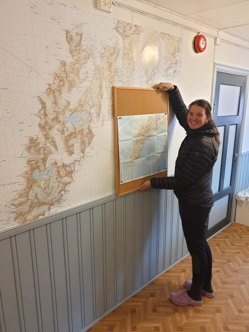
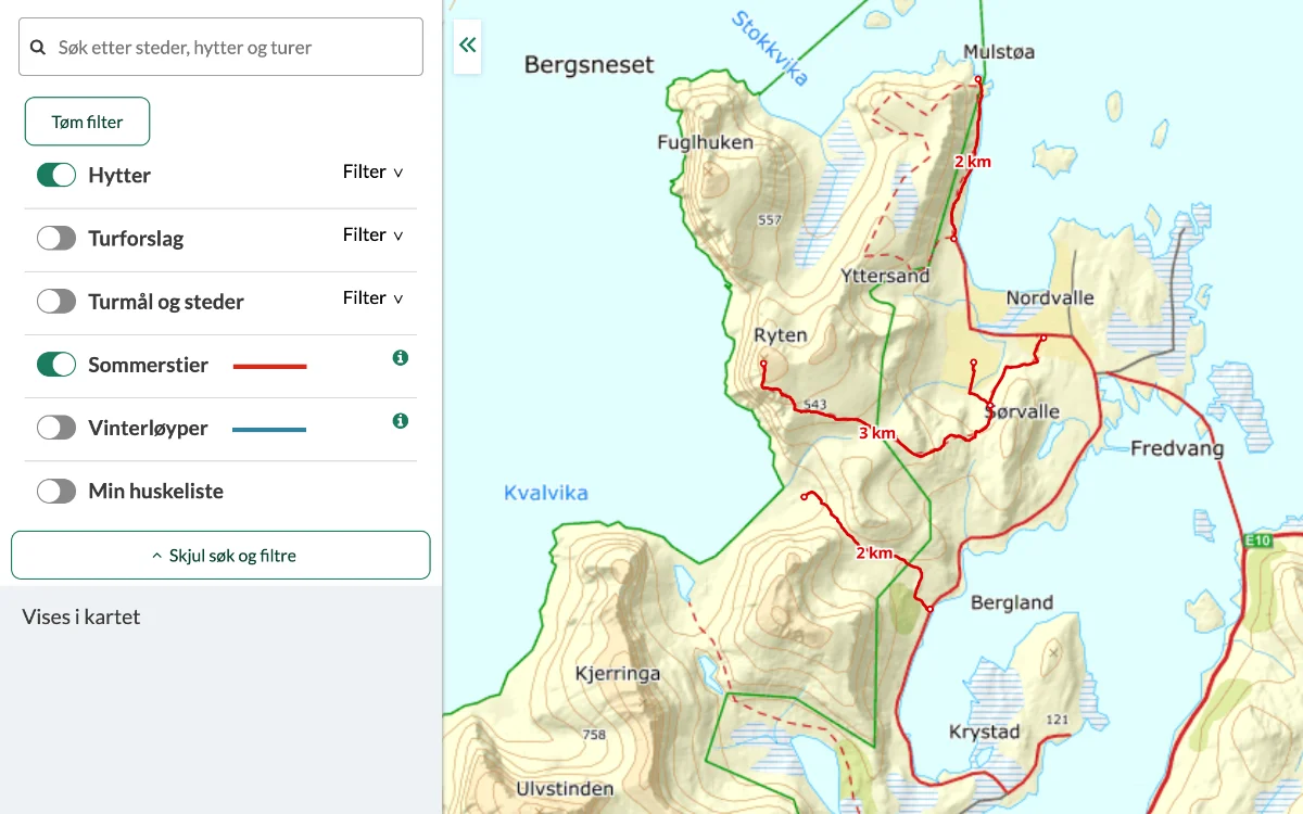
KARTMANNEN: PRINTING A MAP OF LOFOTEN IN HIGH RESOLUTION
We stumbled upon this webpage while searching for a map we could print in a big size and put on the wall. As I mentioned, we have been running an accommodation in Lofoten, located right at the trailhead to Kvalvika Beach and Ryten. So naturally, we wanted a big enough map to show our guests the hiking possibilities in the vicinity of the accommodation.
Luckily, we found Kartmannen! This excellent webpage allows you to choose a map scale that fits your needs and export any area into a pdf map you can later print. The finer the scale of a map, the more details it shows and the lesser area it covers.
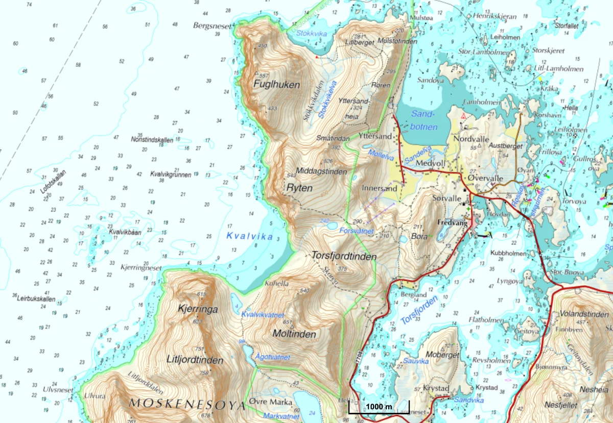
For example, overview maps typically have a scale of 1:50,000 to 1:100,000, meaning that one unit on the map (e.g., inch, centimeter) equals 50,000 or 100,000 units in the field. For our hiking trips, we like to print sections of the map in 1:25,000 – 1:50,000.
NORGESKART: NORWEGIAN APP FOR HIKERS
Norgeskart is a fantastic map and app for hiking, fishing, or sailing in Norway (it shows you the water depth). It includes a lot of hiking trails all over Norway, and it works perfectly online. However, you must pay a premium membership to download offline maps.
UT.NO: OFFICIAL MAP FROM THE NORWEGIAN TREKKING ASSOCIATION
UT.no is a Norwegian trip planning website and an app developed by the Norwegian Trekking Association (DNT). It contains information about hiking trails, skiing tracks, and mountain huts.
Unfortunately, it is only available in Norwegian, and google often struggles to correctly translate various Norwegian dialects into English.
Moreover, the user-generated content is often inconsistent (some trips list distance as out and back, others just in one direction), and the sheer amount of places on the map can get overwhelming. Nevertheless, we find this app useful in the early stages of our trip planning.
PAPER MAPS OF LOFOTEN
Beware that you will not have a network connection everywhere in Lofoten, especially if you plan the long crossing of Lofoten or hikes in the Lofotodden national park.
Therefore, if you plan longer and/or remote hikes, we recommend you not only rely on your mobile phone but also have a paper map. You can either print the sections you are interested in from Kartmannen or buy an old-fashioned paper map.
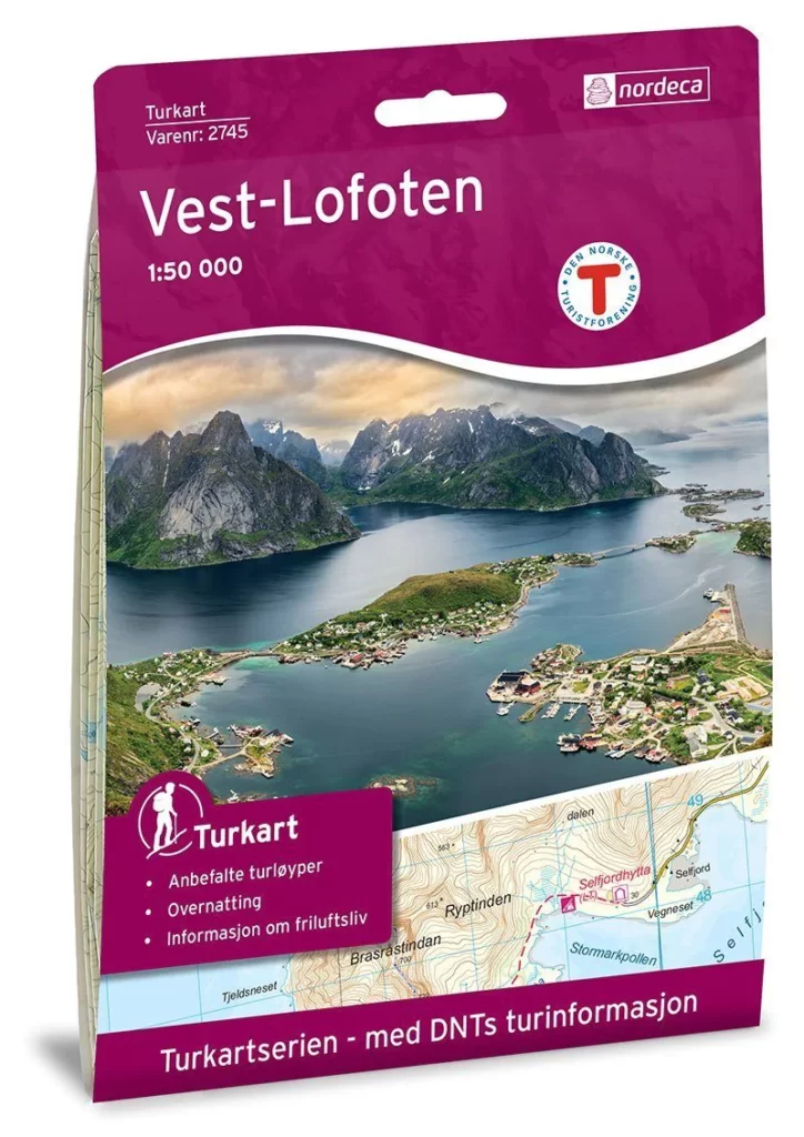
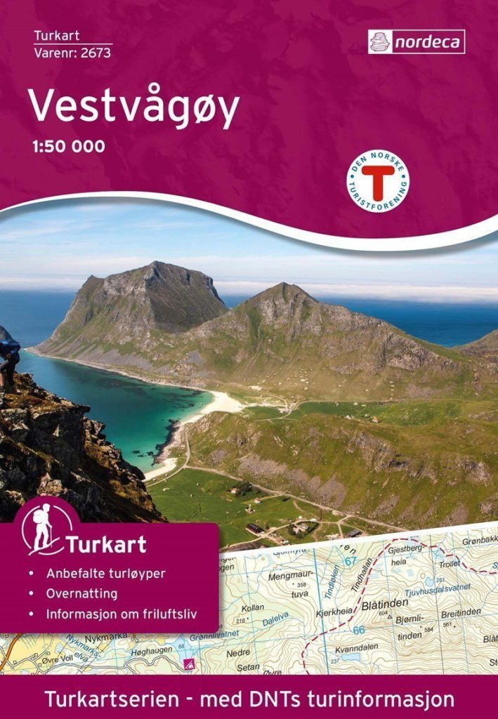
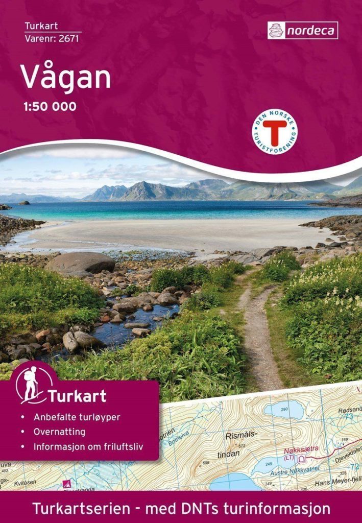
For the Lofoten area, you can get three maps on a scale of 1:50,000 made by the Norwegian publisher Nordeca. You can buy these maps in the tourist information, supermarkets, gas stations, book stores, and sports stores all over the Lofoten islands.
Vest-Lofoten map covers the islands of Røst, Værøy, Moskenesøya and Flakstadøya.
Vestvågøy map focuses on the Vestvågøya island, meaning the area around Leknes.
Vågan map shows the area of Gimsøya and Austvågøya islands, meaning the surroundings of Svolvær.
MARTIN KULHAVY’S MAP OF LOFOTEN
Photographer Martin Kulhavy keeps going to the Lofoten islands at least twice a year to take stunning 360° captures of Lofoten’s peaks. We met Martin in the summer of 2021, and he has been a great resource in helping us plan our hiking trips since he stood on top of every single mountain in western Lofoten you can reach without climbing.
After taking a 360 degrees shots on each mountain top, Martin put together a stunning virtual tour of the islands. Thanks to his map, you can enjoy the views from the Lofoten peaks without any physical effort, so take a seat and enjoy the tour!
Ivar & Radka
Hi! We are Ivar & Radka, an international couple who runs the Guide to Lofoten. We met in Trondheim and lived together in western Norway, Narvik and Tromsø. At the moment we call western Lofoten our home. We hope our page will make it easier for you to explore the beautiful places that made us chose Norway for our home.
While guiding winter trips to Ryten, we’ve seen it all: frozen toes, soaked jeans, people sliding down on their backsides, and others trying to find their way in the dark with a phone flashlight. It’s funny until it isn’t.
Winter hiking in Lofoten is tough, unpredictable, and sometimes flat-out dangerous. This isn’t meant to scare you — it’s meant to
Norway is marketed as a camping paradise. Thanks to the right to roam (allemannsretten), you can still sleep outside of designated campsites, which is pretty amazing. People come here with dreams of fjords, freedom, and falling asleep under the midnight sun.
Lofoten takes that dream and cranks it up to eleven. It’s stunningly beautiful—almost offensively so—and it’s no surprise
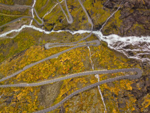
Trollstigen, also known as the Troll Road or Troll’s Ladder, is on almost everyone’s Norway bucket list. With its eleven hairpin bends, dramatic mountain drops, and epic views, it’s easy to see why.
That’s why so many people were disappointed when the road stayed closed for the entire summer season of 2024 following a series of rockfalls.