160+ reviews
160+ reviews

The winter closed roads in Norway are not main highways.
Most of them are:
Narrow, winding, scenic mountain roads, often part of Norway’s famous 18 National Scenic Routes, which were built to take you to the most beautiful (and remote) places in the country.
They often have steep slopes, avalanche risk, and no good way to keep them maintained once the snow piles up.
So, rather than trying to keep these roads open at all costs, the Norwegian Public Roads Administration closes them for the season — usually sometime in October or November– and reopens them between March and June, depending on the weather.
In addition to the winter-closed roads, we’ve added a few major roads to the article — like the E6 over Saltfjellet in Northern Norway and the road over Hardangervidda — that also cross mountain passes and can be temporarily closed for several hours due to challenging weather.
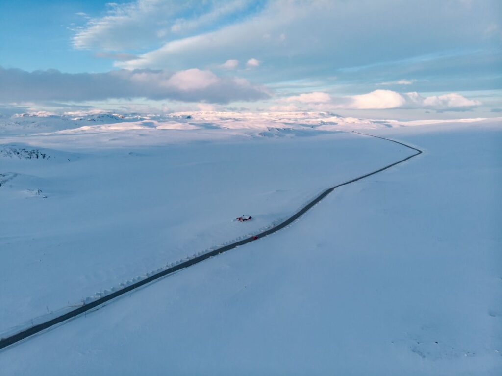
Here comes the answer nobody likes: It depends.
How much snow fell during winter
How fast the snow melts
What is the altitude of the road
Some roads open as early as March, while others don’t open until late May or even June.
To make it even more unpredictable, an open road in early May can close again the next day if a snowstorm hits. That’s just how mountain weather works in Norway.
Now, let’s look at the typical opening times for the most popular winter closed roads in Norway and how you can stay updated on their current status.
These are some of the 18 National Scenic Routes — Norway’s most breathtaking drives — and also the ones most likely to mess up your road trip if you don’t plan carefully.
Part of the 18 National Scenic Routes.
Trollstigen is one of the most popular tourist attractions in Norway. It’s also one of the most photographed scenic roads in the country.
Additionally, it’s often marketed as one of the most dangerous roads in the world, but that’s more drama than reality.
Yes, the drop is steep, and the road is narrow, but it’s paved, well-maintained, and completely fine to drive. You’ll meet motorhomes, rental cars, and even full-size tourist buses making their way up and down.
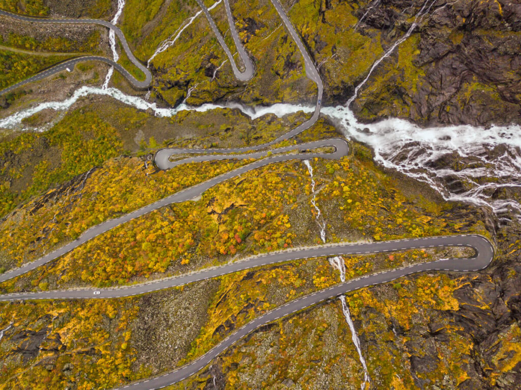
The main challenge with Trollstigen is actually when it’s open. The road usually closes with the first snow in autumn (sometimes already in October) and doesn’t open again until late spring or early summer, once the avalanche danger is over.
There are so many question marks around the 2025 opening dates for Trollstigen (aka Troll Road) that we decided to write a whole separate article just about it.
Check out our full update here: Trollstigen Opening and Closing Dates 2025
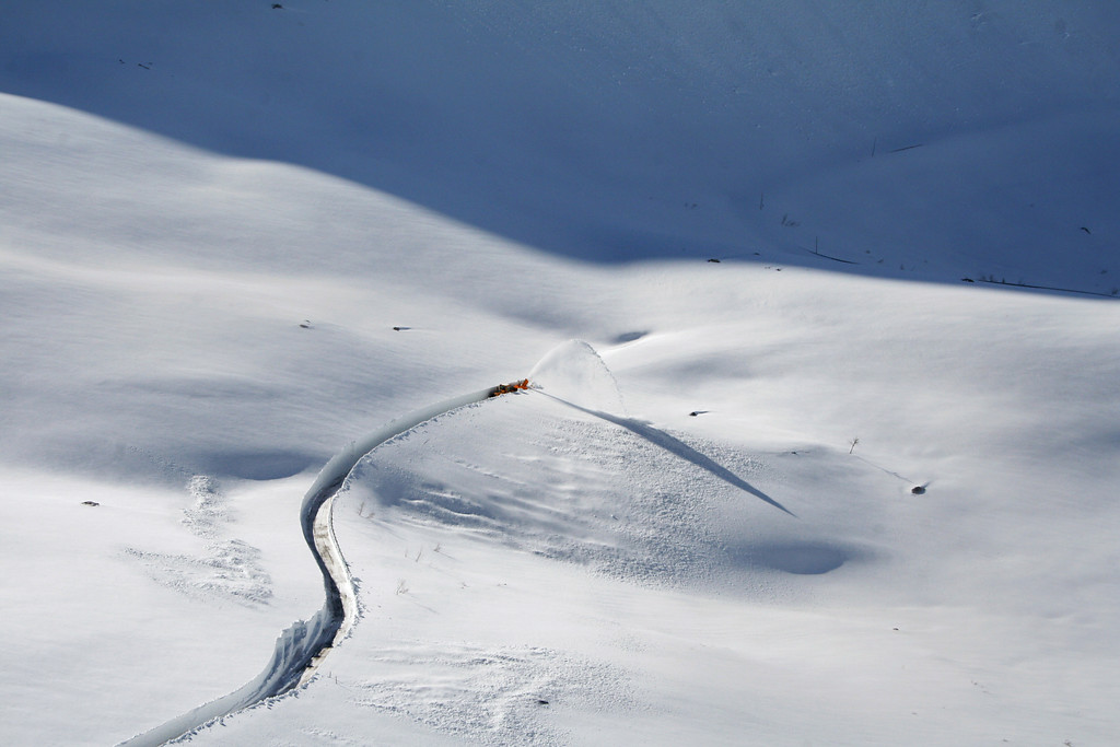
Usually opens sometime in May, but sometimes not until mid or late June. This year, Trollstigen is expected to open on July 14, 2025.
Normally closes in late October or November, but sometimes as late as December. For the next three years (2025–2027), Trollstigen is expected to close on July 31 each year due to ongoing rockfall protection work.
Check Vegvesen for the latest info on the opening and closing dates of Trollstigen.
Check the weather for Troll Road (Trollstigen) on yr.no.
Part of the 18 National Scenic Routes.
Aurlandsfjellet is one of Norway’s scenic roads, and it gets a lot of attention because it starts right above Aurland and Flåm — two of the busiest tourist spots in the fjords that tourists visit on their Norway in Nutshell tour.
Most people drive up to Stegastein viewpoint, take the photo, and turn around. But the road actually continues all the way over the mountains to Lærdal, and it’s worth doing if the weather is good and the road is open.
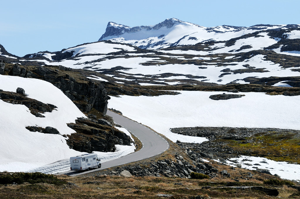

Closed on October 22, 2024
Expected to reopen around May 1, 2025 (estimate)
Check Vegvesen for the latest info on the opening and closing dates of Aurlandsfjellet.
Check the weather for Aurlandfjellet on yr.no.
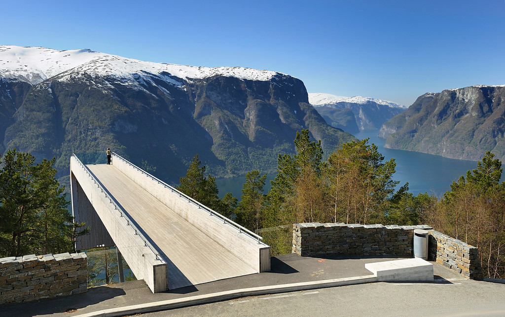
Part of the 18 National Scenic Routes.
Valdresflye is one of the easier mountain passes to drive in Norway — open, spacious, and with long, gentle curves instead of tight hairpins.
The road crosses the mountain plateau between Garli and Maurvangen, with big sky views and great access to the Jotunheimen mountain range. It’s a favourite with cyclists, motorhomes, and hikers heading into the national park.
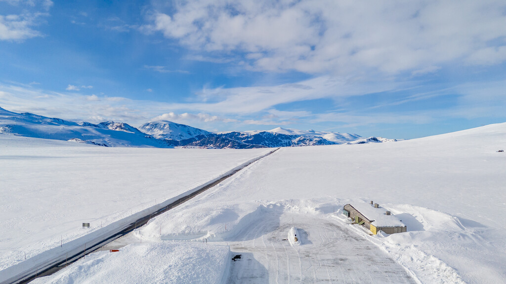
Valdresflye is usually one of the first scenic mountain roads to open each year — often already in late March or early April.
The road typically closes for winter in late October or sometime in November, depending on snow and conditions.
It can also close temporarily in spring and autumn, especially during bad weather, or sometimes it is closed at night.
Check Vegvesen for the latest info on the opening and closing dates of Valdresflyet.
Part of the 18 National Scenic Routes.
Sognefjellet is the highest mountain pass open to cars in Northern Europe, reaching its highest point at 1,434 metres above sea level.
Driving this road feels like crossing the roof of Norway — remote, wild, and unforgettable.
You’ll pass right by Galdhøpiggen, Norway’s tallest mountain, and you might even spot the ice-covered Smørstabbreen glacier from the roadside.
If you’re planning a road trip between eastern and western Norway, and the timing is right, it’s a stunning alternative to the faster lowland routes.
Closed on October 30, 2024
Expected to reopen around May 10, 2025 (estimate) – opened on April 25, 2025
Check Vegvesen for the latest info on the opening and closing dates of Sognefjellet.
Check the weather for the Sognefjellet road on yr.no.
Part of the 18 National Scenic Routes.
Gamle Strynefjellsvegen is one of Norway’s most charming scenic routes — and a true journey back in time.
This old mountain road was built in the late 1800s to connect Skjåk in the east with Stryn and the fjords in the west.
These days, it’s no longer the main route (there’s a tunnel for that), but it’s easily one of the most memorable.
The road winds its way between Grotli and Videsæter, climbing to just over 1,100 metres above sea level. The road itself is part of the experience — narrow, partly gravel, and lined with old stone guard walls built by hand.
Closed on September 25, 2024
Expected to reopen on June 13, 2025 (depending on snow conditions)
Check Vegvesen for the latest info on the opening and closing dates of Gamle Strynefjellvegen.
Check the weather for the Strynefjellet road on yr.no.
Not part of the official 18 Scenic Routes, but absolutely stunning.
The road between Geiranger and Langvatn might not be one of Norway’s official scenic routes, but it easily could be. It climbs quickly from the fjord, passing waterfalls and snow patches before crossing a high plateau and connecting to the main road between Lom and Stryn.
In summer, it’s a spectacular crossing. You’ll drive past melting snowbanks, mirror-like lakes, and some of the most rugged terrain in the region.
But this is a mountain pass — and like most high roads in Norway, it’s closed in winter.
Closed on November 15, 2024
Expected to reopen around April 21, 2025 (depending on weather and snow-clearing) – opened on April 25, 2025
Check Vegvesen for the latest info on the opening and closing dates of Geiranger – Langvatnet.
Check the weather for Geiranger – Langvatnet road on yr.no.
The Ørnesvingen (Eagle Road), on the opposite side of Geiranger village, is open all year, so even in winter, you can still drive up and get the iconic fjord view.
Not part of the 18 Scenic Routes, but a breathtaking detour.
The road to Dalsnibba is one of the highest you can drive in Norway, leading up to the Geiranger Skywalk at 1,500 metres above sea level.
It starts just outside Geiranger and climbs steeply through hairpin bends and open mountain terrain. On a clear day, the view over the fjord and surrounding peaks is hard to beat.
The upper section is called Nibbevegen, and it’s a private toll road. It’s fully paved, open to regular cars, and you need to pay to use it.
Expected to open in late May 2025
Expected to close in early October 2025 (weather dependent)
Check Dalsnibba.no for the latest info on the opening and closing dates of Dalsnibba road.
Toll price: 350 NOK (2025) for a private car. (You can pay at the gate or buy tickets online — just make sure to download them in advance since there’s little to no signal in the area.)
Not part of the 18 Scenic Routes, but a popular road for the Kjeragbolten hike.
The road between Sirdal and Lysebotn is one of Norway’s wildest mountain drives — and the only road access to the tiny fjord village of Lysebotn.
It’s also the main access point for hiking to Kjeragbolten, the famous boulder wedged between two cliffs high above Lysefjord.
The road climbs over the mountains from Sirdal and drops more than 900 metres down to sea level in a short distance, with 27 hairpin bends and a narrow tunnel that twists its way through the rock.
The road closed on November 30, 2024
Expected to reopen on June 1, 2025
Check Vegvesen for the latest info on the opening and closing dates of Sirdal – Lysebotn.
Part of the 18 National Scenic Routes.
Route 7 over Hardangervidda is open all year, but it crosses a high mountain plateau and is known for harsh weather — especially in winter and early spring, which can lead to temporary road closures or convoy driving with snowplow escorts.
Check Vegvesen for the latest info on the road conditions on the Hardangervidda plateau.
Check the weather for Hardangervidda road on yr.no.
Not part of the 18 Scenic Routes, but a legendary route.
Yes, you can drive to the “northernmost point” in Europe in winter — but not always on your own terms.
The final stretch from Skarsvåg to Nordkapp often requires convoy driving in autumn/winter/spring due to wind, snowdrifts, and whiteouts.
Even though the road is kept open during the winter, temporary closures happen often — sometimes several times in a week.
Check Vegvesen for the latest info on the road conditions on the Nordkapp plateau.
Check the weather forecast for Nordkapp on yr.no.
Not part of the 18 Scenic Routes, but a main road crossing the Polar circle.
The E6 over Saltfjellet crosses the Arctic Circle and is one of the key north–south routes through Norway.
It’s open year-round, but in winter, it’s exposed and often hit by severe weather.
Strong winds, snowdrifts, and icy roads can lead to short-term closures or convoy driving — especially in the stretch between Lønsdal and Bolna.
Check Vegvesen for the latest info on the road conditions on the Saltfjellet mountain pass.
Check the weather forecast for Saltfjellet on yr.no.
If a road is officially closed for the winter, Google Maps won’t show it as an option.
So if you’re trying to plan a scenic route anytime between October and late May/early June and wondering why Google keeps sending you the long way around, that’s the reason.
The road is most likely closed due to snow, and Google (rightly) assumes you don’t have a snowplow attached to your rental car.
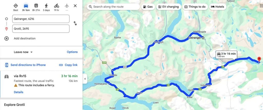
Don’t plan your summer road trip in the middle of winter, when Google Maps won’t show those scenic routes.
Or better yet — don’t rely on Google Maps at all when planning a spring or early summer trip through the mountains.
Instead, try Mapy.cz — It tends to handle Norway’s seasonal road closures better and gives you a more realistic idea of what’s possible.
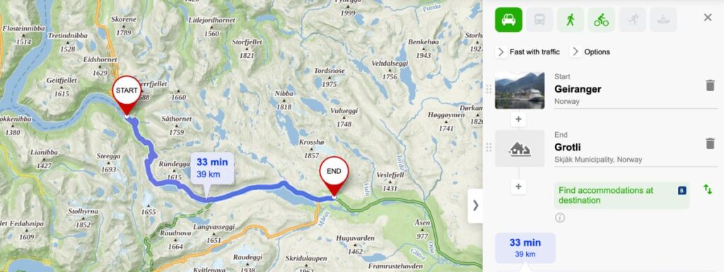

5.0 (160+ reviews)