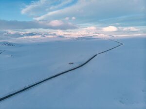
Hiking Ryten in Winter: Safe Alternative to Reinebringen

If you’re eyeing a winter adventure in the Lofoten Islands, hiking Mt. Ryten in winter could be just the ticket. This mountain is an “easily accessible” hike for those looking to experience the beauty of western Lofoten without venturing into the more treacherous terrains.

That said, don’t let the word ‘accessible’ fool you; a winter hike here means you’ll need the right gear, like snowshoes or microspikes, especially before April rolls around. The weather in these parts can switch from sunny to a snowstorm in no time, so always check the forecast and make sure you’re fully prepared.

At the end of this article, we’ve compiled a handy checklist to help you gear up. And if you’re not too confident about navigating mountainous terrain in winter, consider hiking with an experienced guide. Trust us, the views from the top are well worth the effort, but safety always comes first!


Guide to Lofoten: A mini Trolltunga cliff on top of Ryten mountain

Table of Contents

Is Hiking Ryten in Winter Safe?

Before diving into the essentials of safely hiking Mt. Ryten in winter, let’s first tackle whether this hike is right for you. Given that we can’t see who’s reading our article, making a blanket statement about the hike’s difficulty or safety is challenging. 

You might be an experienced mountain hiker familiar with the challenging terrains of the Alps or the Canadian Rockies, and for you, hiking Ryten under favorable weather conditions may present little to no difficulty. On the other hand, the hike could prove significantly more challenging if you’re from a bustling city or a region known for its warm weather and not accustomed to navigating snowy landscapes.

The point here is that the perceived ease or safety of hiking Mt. Ryten in winter varies greatly depending on your experience and familiarity with winter hiking conditions.

If you’re unsure about taking on the Ryten hike during winter, we highly recommend contacting us for a guided tour. 


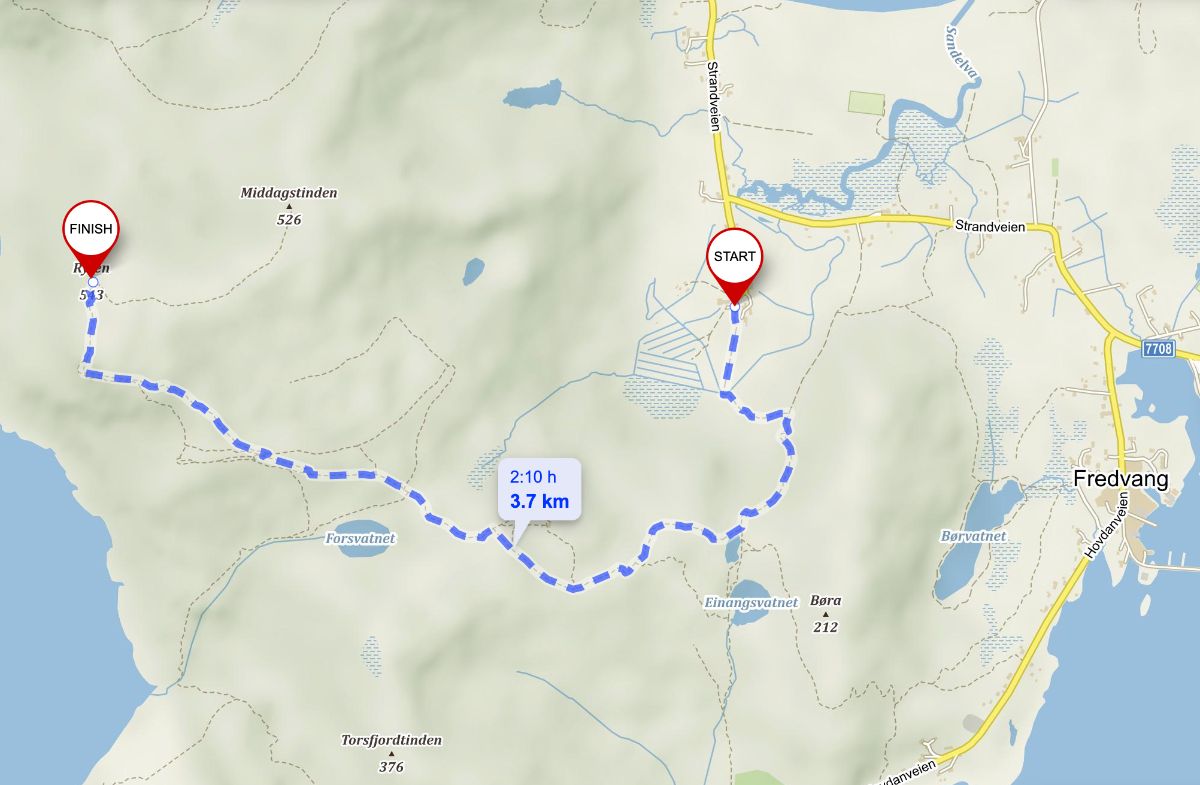
Ryten Winter Hike Stats & Map

Distance: 7 km (out and back)
Elevation Gain: 520 meters
Duration: 3-4 h(out and back)
Difficulty: Moderate
Starting point: Paid parking in Innersand/Indresand


Guide to Lofoten: How to hike Ryten from Innersand_hiking map

Ryten Winter Hiking Map


What to expect from hiking Ryten in winter?

If you plan to hike Ryten in winter, you’ll be tackling a 7km trip back and forth, with a climb of about 500m. 

How long the hike takes really depends on a few things. Your fitness level is a big factor; if you’re used to hiking, you might move faster, but if you’re not, it could take you longer. You might also want to stop a lot to take pictures or videos because it’s beautiful out there, adding more time to your hike.

The path condition is another thing to think about. If there’s a lot of deep snow, walking can be tough and slow you down. Ice on the trail means you have to be extra careful not to slip, making you go slower.

And then there’s the weather. Lofoten can have strong winds and whiteouts that make it hard to see, making your hike longer and more challenging.

So, while the winter hike to Ryten might seem short distance-wise, how long it actually takes varies a lot from person to person and day to day. It’s always good to give yourself plenty of time to enjoy your hike safely and not feel rushed.


Hiking Ryten from Innersand in early April


Ryten in winter

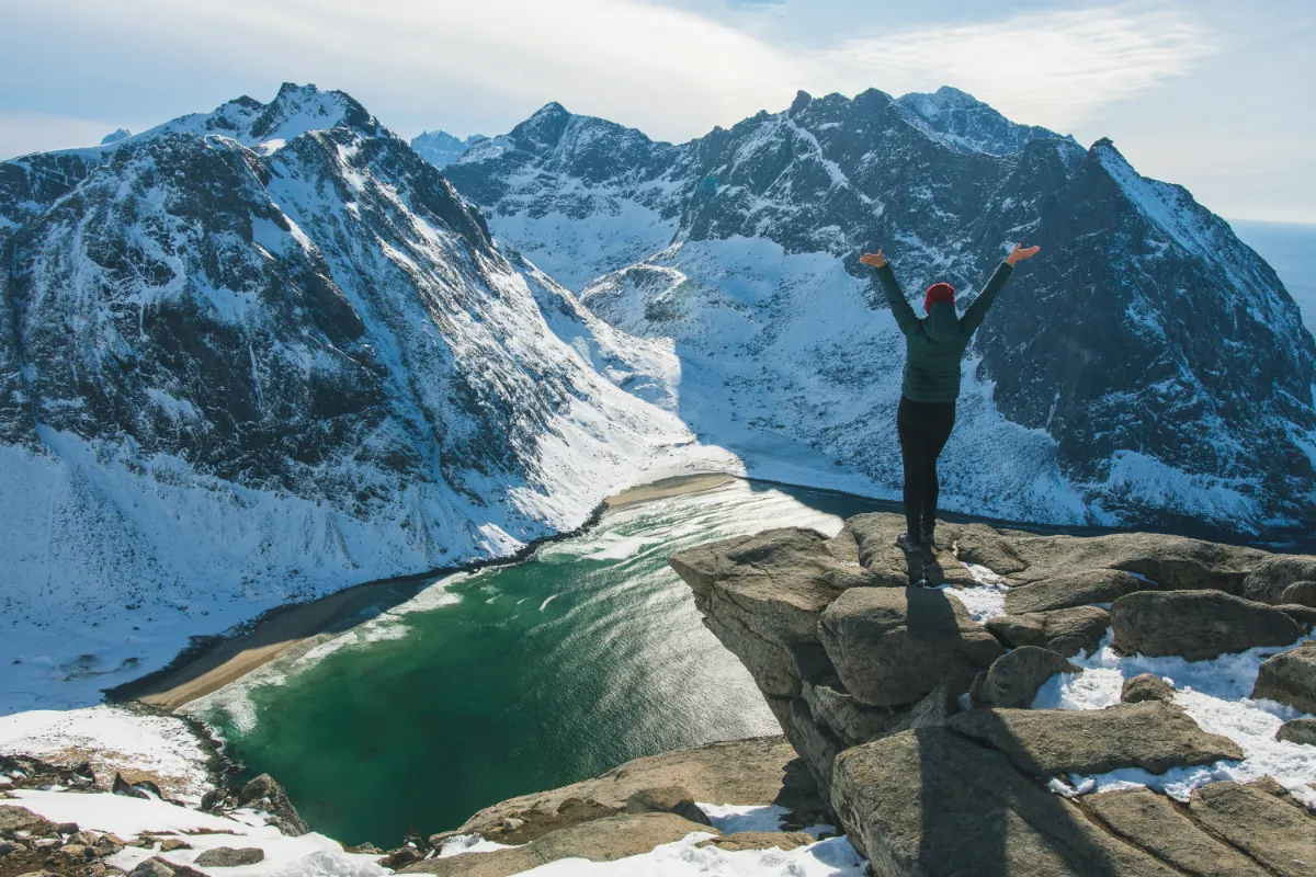
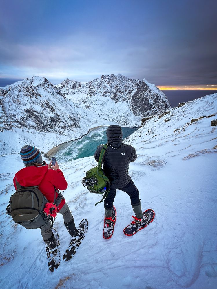
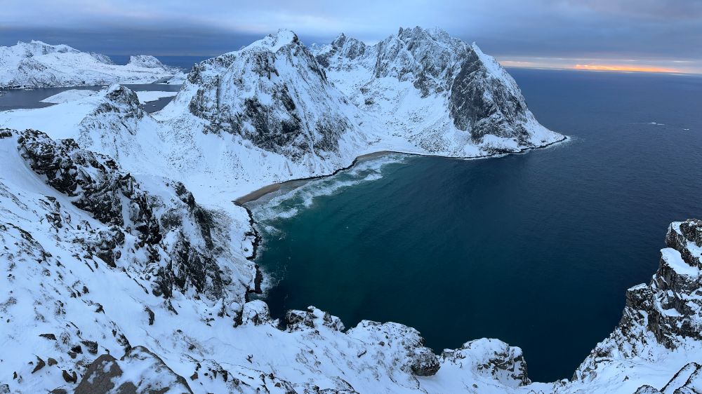
View from the top of Ryten towards Kvalvika Beach in February


hiking ryten in february

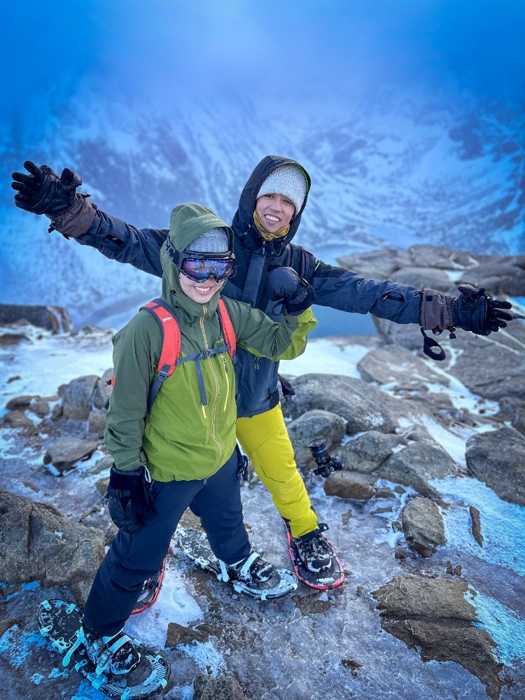
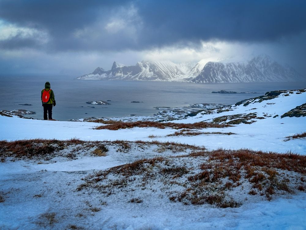
February winter hike to Ryten – the weather changed suddenly at the top, and on the way down, you could hardly see two steps ahead of you.


Where to park for hiking Ryten in winter?

During winter in Lofoten, finding a plowed spot for parking can be tricky because not all parking areas and road shoulders are cleared of snow.

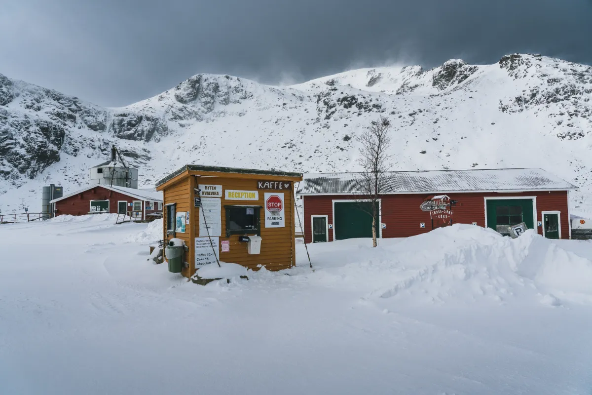
Your safest bet for parking when hiking Ryten is at Leif’s parking lot at Innersand. Leif makes sure to keep a portion of this parking area plowed and open throughout the winter season. Parking there will cost you 100 NOK (Norwegian Krone) per day.

Since there’s no attendant in the morning during winter, you’ll need to pay in cash. Look for a mailbox at the entrance where you can drop your parking fee.


Paid parking for Ryten and Kvalvika in Innerdsand close to Fredvang

Parking for Ryten hike at Leif’s place in Innersand


Are you Planning to Hike Ryten and/or Kvalvika in the summer?

Ryten Trail Guide

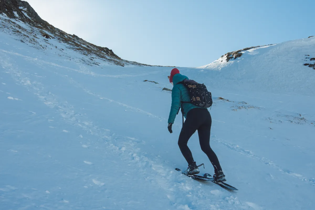
The first Part is the most difficult.


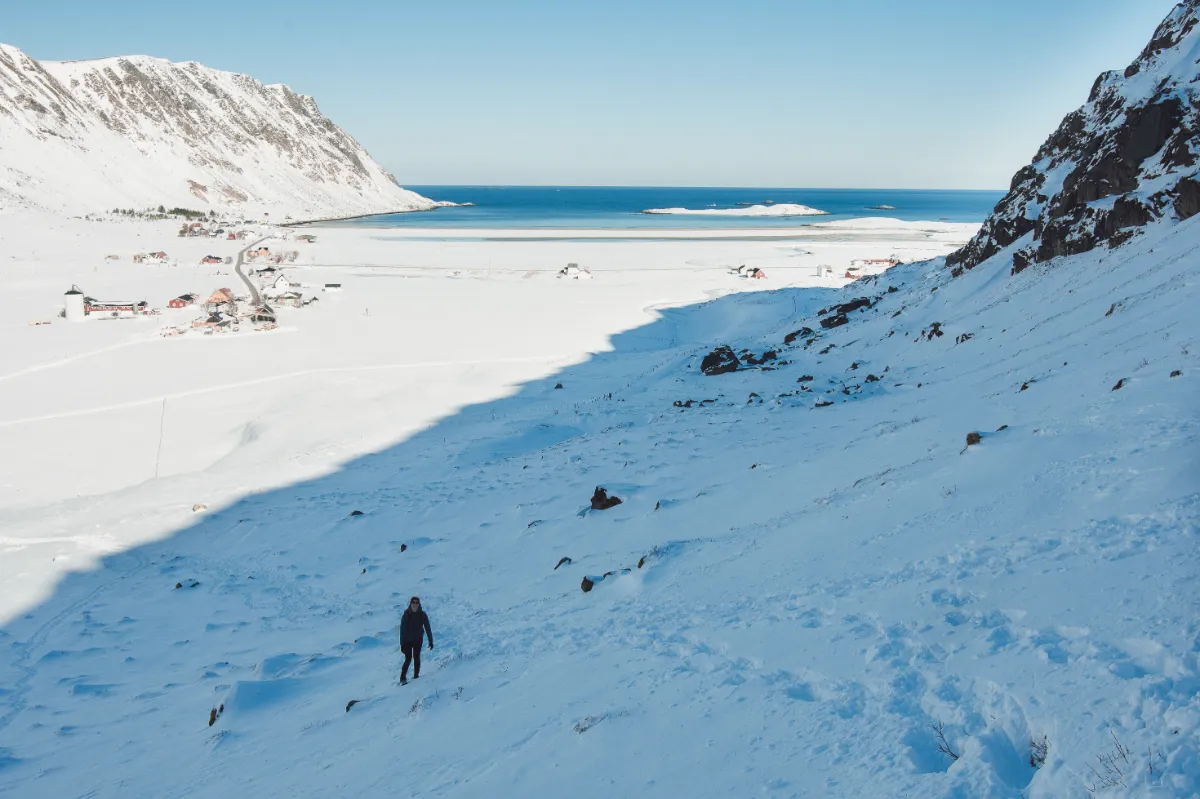
The trail to hike Ryten starts directly from the parking area and is typically easy to follow, except when there’s a lot of fresh snow, and you’re the first one heading up for the day.

The initial climb right from the parking is the steepest and toughest part of the hike. 

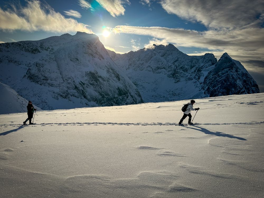
For a winter hike, we recommend using snowshoes and hiking poles, or at the very least, microspikes/crampons along with hiking poles.

Snowshoes and microspikes help you keep a good grip on icy surfaces while hiking poles assist with maintaining your balance.


Guide to Lofoten

The first part of the trail to Ryten. In the background you can see the parking in Innersand.


Do not trust the hiking apps and stay on the left side.

Contrary to what some hiking apps might suggest, staying more to the left is safer as you ascend the hill.

This way, you’ll avoid walking under a snow cornice that often forms there. Snow cornices can be dangerous because they can unexpectedly break off, posing a risk to hikers below.

Do not trust the hiking apps and stay on the left side.


The first hill is the most difficult


Avoid going too close to the cliffs.

Once you reach the top of the first steep hill, you’ll find no more tricky or dangerous sections ahead on the trail. The climb becomes gentler from here, and the landscape opens up, offering broader views.

After passing Forsvatnet Lake, where the trail splits with one path leading to Kvalvika Beach and the other continuing towards Ryten, keep going towards Ryten.

However, it’s important to stay a good distance away from the cliffs on the left side.


Even in early April, snowshoes might still be a good idea


It gets windy on the top.

As you approach the summit of Ryten, the wind often picks up because there’s nothing between you and the open ocean to block it. If you’re thinking about taking a break to drink some tea or a snack, it’s often best to do so before reaching the top.


Ryten in winter

The view along the route towards the mountains on Flakstad Island


Miniature Trolltunga is risky in winter.

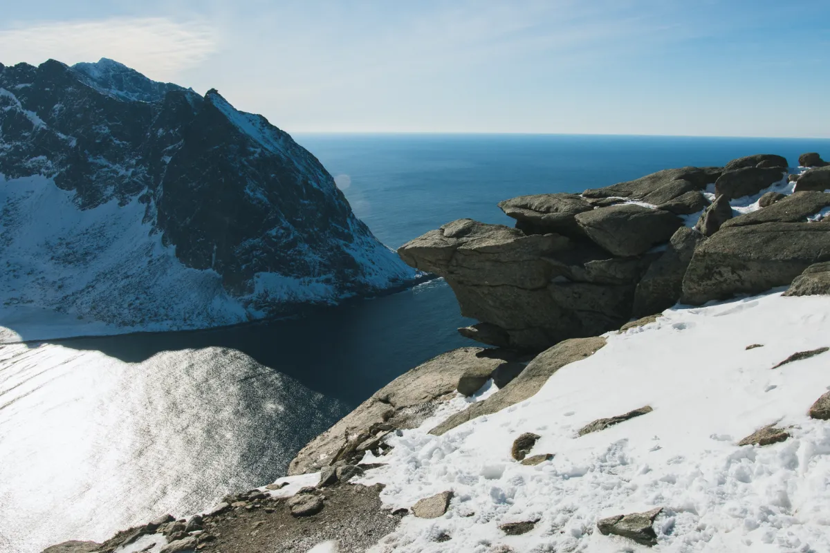
Close to the summit, you’ll find the famous cliff resembling a miniature version of Trolltunga. During summer, many people take dramatic photos here, often appearing to hang off the stone with what seems like a massive drop below.

These photos, while impressive, can be misleading; the spot isn’t as dangerous as it looks from certain angles, but it’s not entirely safe either.

In winter, we advise against trying to pose on this stone. The combination of icy conditions, strong winds, or sudden gusts makes it particularly risky.


miniature trolltunga on top of ryten in winter

The miniature Trolltunga close to the summit of Ryten


Return hike.

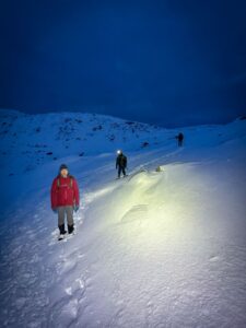
Sometimes, clouds can swiftly envelop the top of Ryten, leaving you in a sudden whiteout.

It’s important to carefully manage your phone’s battery life, not using it all for photos and videos at the summit, because you might need it for navigation on the way down.

Phone batteries drain faster in cold conditions, so bringing a fully charged power bank is a wise precaution.


Do you want to rent snowshoes or hire a local guide?

Weather forecast for Ryten and Fredvang

There’s a Scandinavian expression that captures the essence of winter hiking: “There’s no such thing as bad weather, only bad clothing.” However, whoever created this phrase has probably never been to Lofoten. We do have bad weather, or as we call it, “stay at home and do not try to go out the door weather.”

Lofoten is not so extreme when it comes to winter temperatures—we rarely have temperatures colder than minus ten degrees. However, people often cannot imagine how windy it can get here, and they ignore wind strength when checking the weather forecast.

Also, when you are checking the weather forecast, make sure that you are not looking just at Fredvang (the nearest village to the trailhead) but also at Ryten. The temperature and wind strength can differ quite a bit between these two locations.
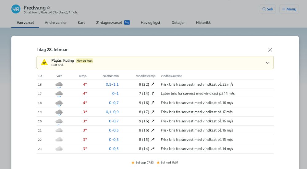
 

Weather forecast for Fredvang (the village near the trailhead).
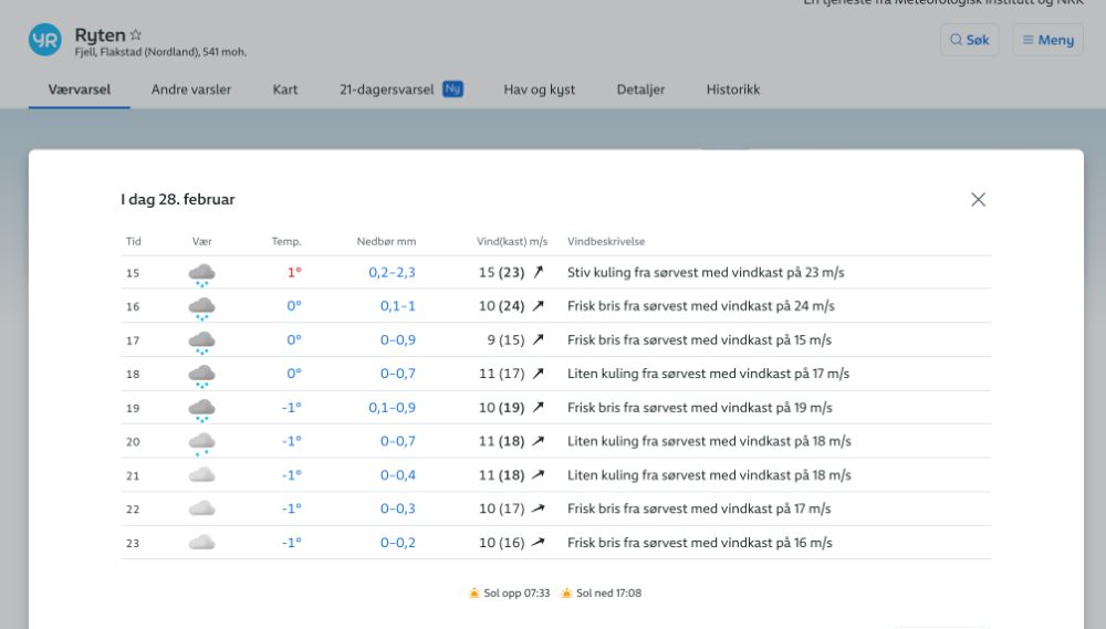
 

weather forecast for Ryten

Weather Forecast for Ryten. You can see it is a few degrees colder and more windy up there.


How windy is too windy to hike?

When you check the wind speed forecast on yr.no, you’ll notice two numbers. The one on the left indicates the average wind speed, while the higher number on the right (in brackets) represents the wind gusts.

Wind gusts are sudden, brief increases in wind speed, usually lasting less than 20 seconds. They can be significantly stronger than the average wind speed. These gusts can greatly impact your hiking experience by making it harder to keep your balance, increasing the cold you feel, and potentially creating unsafe conditions.

There isn’t a unanimous agreement on the exact wind speed that makes mountain hiking too risky, but since many people can’t quite picture what different wind speeds feel like, we’ll share the guideline we use.

Generally, we do not go mountain hiking in winter when the average wind speed exceeds 10 m/s (36 km/h or 22 mph) and wind gusts are predicted to be above 15 m/s.


Ryten Winter Packing Guide

Stay warm and dry


Many people believe the main job of winter clothing is to keep them warm. However, that’s only half the story. Good winter gear must keep you both warm and dry.

If you’re wet, your body will lose heat much faster than if you’re cold but dry. Rapid loss of body heat can quickly lead to a dangerous drop in your core body temperature, potentially resulting in hypothermia. Therefore, the most crucial strategy for staying safe in cold conditions is to keep dry, as maintaining your body’s warmth depends significantly on it.

Avoid bringing cotton since it dries slowly and doesn’t insulate well when wet. Choose quick-drying materials, such as wool or polyester, that keep you warm even when damp.

Since hiking involves different levels of physical effort (for example, going uphill is usually more strenuous and causes more sweating than going downhill), it’s essential to wear clothing that you can easily adjust. This means adding layers when you’re cold or removing them when you feel too warm. The goal is to maintain a comfortable temperature and minimize sweating, thus staying dry.

We discuss the layering system in more detail in our article about what to pack for Lofoten in winter.


 

what to pack for Lofoten in winterinner layer thermal underwear

what to pack for Lofoten in winter middle layer woolen sweatshirt

what to pack for lofoten in winter outer layer hard shell jacket

Lofoten Winter Hiking Packing Essentials

Here’s a comprehensive list to ensure you’re well-prepared for the cold and changing conditions:

Winter Clothing

Base Layer: Moisture-wicking materials like merino wool or synthetic fabrics to keep you dry from sweat.
Insulating Layer: Fleece or down jackets for warmth.
Outer Layer: Waterproof and windproof jacket and pants to protect against snow, rain, and wind.
Hat, Gloves & Neck Warmer/Buff
✅ Warm Socks
✅ Gaiters


Winter Footwear

Insulated, Waterproof Hiking Boots
Microspikes or Crampons
Snowshoes (contact us for snowshoe rental; we arrange pick up in Fredvang, close to the trailhead to Ryten)


Additional Equipment

✅ Backpack
✅ Hiking Poles
✅ Headlamp
✅ Sunglasses: Even when cloudy. They offer protection against rain and snow in your eyes when windy.
✅ Sunscreen
✅ Insulated Water Bottle or Thermos
✅ First Aid Kit
Navigation Tools: Map, compass, GPS device, and possibly a trail app on your phone. Ensure your phone is fully charged.
Power Bank: To keep your electronic devices charged.
✅ Snacks: High-energy, easily consumable foods that won’t freeze.
Do you wonder what to expect from Lofoten in winter?

Best Hikes in Lofoten: Interactive Map

If you’re planning to explore the rugged beauty of the Lofoten mountains, we highly recommend equipping yourself with our interactive hiking map.

The interactive map features 50 trails across Lofoten, each color-coded according to difficulty level.

You’ll find comprehensive details for each trail, including distance, elevation gain, estimated duration, and parking information.

We’ve also included concise descriptions highlighting any tricky or exposed sections, along with links to the route on a hiking map. This feature is incredibly helpful for planning your adventure, especially when you have limited time and want to select a hike that fits your schedule.

Best of all, our map is seamlessly integrated with the Google Maps app, making it easy to use without the need for additional downloads – except for mapy.cz, which is an invaluable hiking app that we highly recommend.


best hikes in lofoten_ interactive hiking map of the lofoten islands_0


Winter Hiking in Lofoten: Final Thoughts

Winter in Lofoten is a real treat. Imagine walking through a snowy wonderland with the chance to see the Northern Lights. While some hikes like Reinebringen are risky because of avalanches and not really recommended, Ryten is a great pick. It’s beautiful, safer, and doable even in winter.

But, let’s keep it real. Just because Ryten isn’t super high doesn’t mean it’s a walk in the park. Ivar has guided lots of trips up there, and you’d be surprised how many folks he sees unprepared, trying to wade through snow in jeans or without the right gear like snowshoes or poles. Trust us, the weather up there can change in the blink of an eye from sunny to can’t-see-your-hand-in-front-of-your-face.

So, here’s the deal: always check the weather before you go, get to know the trail, make sure your phone’s charged and has an offline map and the hjelp113 app just in case. Double-check you’ve got the right clothes and gear. And remember, there’s no shame in turning back if it gets too tough or the weather turns bad.

Take care, and happy hiking!

Ivar & Radka ❤️


guide to lofoten_about us_ivar and radka_52

Hi there, this is us: Radka and Ivar:)


More Lofoten Planning Resources

✅ How to get to the Lofoten Islands
(Travel to Lofoten by plane, bus, train, car or ferry)

Best Airports in Lofoten

(Which Airport in Lofoten or its surroundings should you choose? Bodø, Harstad/Narvik, Leknes, Svolvær or Tromsø?)

✅ All You Need to Know About the Bodø-Moskenes Ferry

(The ferry schedule, prices, pre-booking, and how to take the Bodø-Moskenes ferry for free)

✅ How to Get from Tromsø to Lofoten
(Overview of different summer and winter routes between Tromso and Lofoten)

✅ Where to stay in the Lofoten Islands

(Overview of traditional fishermen cottages-rorbuer, hotels, hostels, and campsites)

✅ Drone Flying in Lofoten
(How do you fly your drone legally in Norway? Where is it forbidden to fly drones in Lofoten?)

✅ Driving in Lofoten

(10 common mistakes tourists often make when renting a car and driving in Lofoten)

 What to do in Lofoten besides hiking?

(15 amazing summer activities you can try in Lofoten, from surfing to kayaking under the midnight sun!)

✅ What to pack for Lofoten in winter?

(Explanation of the layering system, example of a packing list for Lofoten or northern Norway in winter)

✅ Northern Lights Forecast for the Lofoten Islands
(Why is the local weather forecast more important than the aurora forecast?)

Picture of Ivar & Radka

Ivar & Radka

Hi! We are Ivar & Radka, an international couple who runs the Guide to Lofoten. We met in Trondheim and lived together in western Norway, Narvik and Tromsø. At the moment we call western Lofoten our home. We hope our page will make it easier for you to explore the beautiful places that made us chose Norway for our home.

More about us

Share:

Facebook
Twitter
Pinterest
LinkedIn
Ivar and Radka Guide to Lofoten

Hi! We are Ivar & Radka, an international couple who runs the Guide to Lofoten.

Most popular posts

Related Posts

reindeer in Tromso
Christmas

Christmas in Tromso 2024: Honest Guide & Opening Times

I could start by painting a picture-perfect scene of snowy landscapes, cozy Christmas markets, the smell of freshly roasted almonds, and gluhwein, with Christmas carols playing in the background while the Northern Lights dance above your head. That’s what most people imagine when they think of Christmas in Tromsø.
I’ve checked out a few articles that pop up when

Read More »
whale watching in tromso and skjervoy
northern Norway

Ethical Whale Watching in Tromso: Best Tours (2024)

For over a decade, whale watching in Tromso has become one of the most spectacular winter experiences. From late October to early February, the fjords around Tromsø are a hotspot for large pods of orcas and humpback whales as they follow the herring migration.
Do you want to see or photograph whales in their natural habitat, and do it

Read More »
Relatively clear road on a winter road trip from Tromso to Senja
how to get to Senja

How to get to Senja from Tromsø

Tromsø has become one of Norway’s top winter destinations, especially with the booming Northern Lights tourism. Once people book their vacation to Tromsø, they often start exploring what other incredible locations are nearby and frequently stumble upon Senja, a wild and beautiful island that offers a wilder experience. But how do you get to Senja from Tromso, especially in winter?

Read More »

Leave a Reply

Your email address will not be published. Required fields are marked *